Description
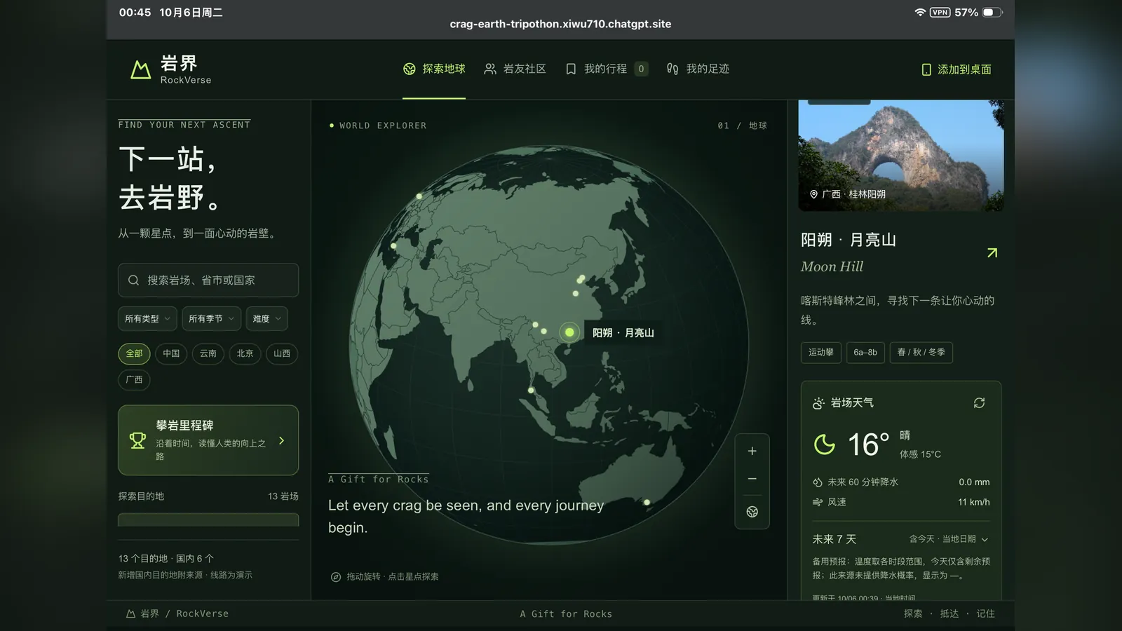
RockVerse is a 3D climbing guidebook built around the globe. It began with a simple problem in outdoor climbing: finding your way around a new crag is harder than it should be. Climbing information is scattered across old websites, communities and PDFs, mostly as text, photos and 2D topos. For first-time visitors, finding a guide is only the beginning; matching the routes to the rock and to their real-world locations is another hurdle.
The team wants to bring that scattered knowledge together. Spin the Earth to discover your next destination. Get close to a crag and learn its routes through 3D models, real photos and route cards. Check in when you arrive, save the routes you want to climb as a trip and share it with the friends you're heading out with, so every visit leaves a mark on your own map.
RockVerse also carries another hope: to put China's crags on the world climbing map. Outdoor climbing tends to bring Fontainebleau in France or Railay in Thailand to mind. Since modern climbing arrived in China in 1987, generations of local climbers have developed routes, maintained crags and shared what they know across the country's vast and varied landscapes. The team wants more people to discover the cliffs of Yangshuo in Guangxi, Honghe in Yunnan, Baihe in Beijing and Datong in Shanxi, along with the route developers, caretakers and everyday climbers behind them.
It is a gift to the rocks and the climbers: making the next trip easier to begin, and helping crags and stories worth seeing travel further.
How Tripo was used
Tripo does more than generate standalone 3D assets here: it turns real crags into explorable spatial guides, and it is the spatial foundation of the experience rather than a visual add-on.
- Pipeline: photos of a real crag go through Tripo to become a 3D model, routes are mapped onto it, and the crag is placed on the globe for exploring and trip planning.
- Role: turning traditional 2D climbing information into an interactive 3D world.